Geophysical prospecting at the site of a Roman villa estate at Baláca
Miklós Pattantyús-Á. – Boriszláv Neducza
(Eötvös Loránd Geophysical Institute of Hungary)
Abstract
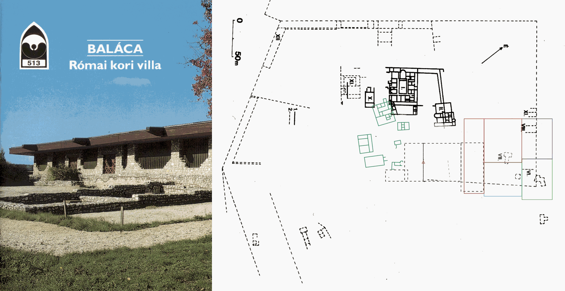
This paper summarises the short history of the geophysical research carried out in Hungary at the Roman archaeological site Baláca in the last twenty years, also mentioning the results of the earlier and contemporary excavation activity concerning the geophysical aspects. The mapping of the NE corner of the Roman villa-estate is discussed in detail.
The first measurements started with resistivity profiling in 1984, only with general overview purposes. On the resulted anomaly map, new – earlier unknown – remnants (traces of building) were discovered. After 15 years of excavation and restoration work, a new geophysical research period started in 1999.
Test measurements with detailed resistivity and radar profiling and mapping were performed near to and around the excavation area. Then measurement site moved toward the NE corner of the villa-estate, systematically mapping the area grid by grid, using the ground penetrating radar (GPR) method. Finally, anomaly maps referring to different depths were constructed about the NE corner.